
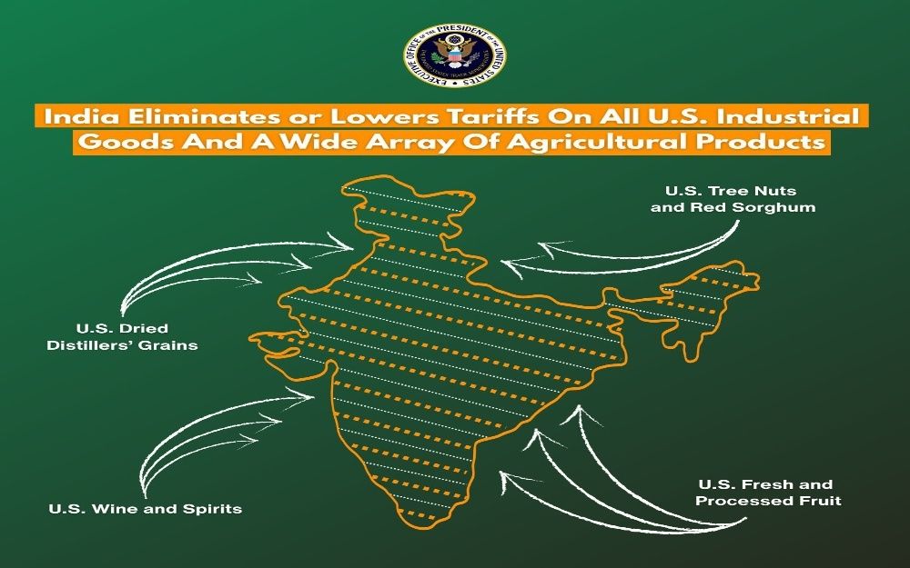
US Map Shows J&K as India, Signals Clear Stand
US Trade Representative graphic includes entire Jammu and Kashmir within India’s borders
- US Trade Representative releases India map including entire J&K
- Graphic linked to new India–US tariff reduction framework
- Move seen as diplomatic signal backing India’s territorial position
- Trade deal also outlines tariff cuts on several goods
GG News Bureau
Washington, 7th Feb: In a development with diplomatic overtones, a map released by the Office of the United States Trade Representative (USTR) has shown the entire region of Jammu and Kashmir as part of India, including areas under Pakistan’s control.
The map appeared in a graphic linked to the new India–US tariff reduction framework, outlining trade concessions and adjustments between the two countries. The visual depiction of India’s political boundaries, with the northern Union Territory of Jammu and Kashmir fully included, is being viewed as a clear signal of Washington’s position on the territorial issue.
The development comes at a time when Pakistan has been attempting to intensify diplomatic engagement with the United States. However, the graphic reflects alignment with India’s official map, underscoring the depth of India–US strategic ties.
Alongside the map, the USTR graphic detailed tariff adjustments under the new joint framework. India has agreed to eliminate or reduce tariffs on several American products, including tree nuts, red sorghum, fresh and processed fruit, dried distillers’ grains, and wine and spirits.
In return, the United States has agreed to reduce tariffs on certain imports from India to 18 percent from 50 percent, while also withdrawing an additional 25 percent duty.
The developments highlight both the economic and strategic dimensions of the growing India–US partnership, with trade and geopolitical messaging converging in a single announcement.